
Filter by
SubjectRequired
LanguageRequired
The language used throughout the course, in both instruction and assessments.
Learning ProductRequired
LevelRequired
DurationRequired
SkillsRequired
SubtitlesRequired
EducatorRequired
Results for "geovisualization"

University of Michigan
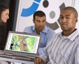
Skills you'll gain: Geographic Information Systems, Geospatial Mapping, Spatial Data Analysis, Spatial Analysis, Interactive Data Visualization, Data Storytelling, Environmental Monitoring, Data Presentation, Forecasting, Trend Analysis
 Status: Free
The Pennsylvania State University
Skills you'll gain: Geographic Information Systems, Systems Thinking, Design Thinking, Geospatial Information and Technology, Spatial Analysis, Community Development, Environment, Design, Environment and Resource Management, Decision Support Systems, Creativity, Cultural Responsiveness
University of California, Davis
Skills you'll gain: Spatial Analysis, ArcGIS, Geographic Information Systems, Geospatial Mapping, Data Quality, Data Mapping, Data Modeling, Data Storage Technologies, Data Storage, Data Processing, Data Manipulation, Databases
University of Illinois Urbana-Champaign
Skills you'll gain: Geospatial Information and Technology, Geographic Information Systems, Apache Hadoop, Spatial Data Analysis, Geospatial Mapping, Big Data, Matplotlib, Data Processing, Computational Thinking, Distributed Computing, Data Manipulation
 Status: Free
École normale supérieure
Skills you'll gain: Data Visualization, Statistical Visualization, Geospatial Mapping, Data Mapping, Geographic Information Systems, Graphic Design, Data Presentation, Graphics Software, Quantitative Research, Color Theory
University of California, Davis
Skills you'll gain: ArcGIS, Geographic Information Systems, Land Management, Geospatial Mapping, Spatial Analysis, Epidemiology, Emergency Response, Natural Resource Management, Business Development, Environmental Resource Management, Market Analysis, Risk Mitigation, Supply Chain

Yonsei University
Skills you'll gain: Spatial Data Analysis, Spatial Analysis, Geographic Information Systems, Geospatial Mapping, Database Management Systems, Big Data, Apache Hadoop, Data Modeling, PostgreSQL, Network Analysis

University of California, Irvine
Skills you'll gain: Apple iOS, Model View Controller, Core Data (Software), User Interface (UI) Design, UI Components, User Interface and User Experience (UI/UX) Design, Responsive Web Design, Mobile Development, Human Computer Interaction, UI/UX Strategy, Data Mapping, Geospatial Mapping, User Experience Design, Storyboarding

Skills you'll gain: Spatial Data Analysis, Spatial Analysis, Geographic Information Systems, Geospatial Information and Technology, Data Analysis, Big Data, Data Visualization, Analytics, Exploratory Data Analysis, Google Cloud Platform, Cloud Management, Data Access, Query Languages
 Status: Free
Coursera Project Network
Skills you'll gain: ArcGIS, Data Presentation, GIS Software, Spatial Data Analysis, Geographic Information Systems, Geospatial Information and Technology, Geospatial Mapping, Data Import/Export, Data Mapping, Data Manipulation
 Status: Free
École Polytechnique Fédérale de Lausanne
Skills you'll gain: Spatial Data Analysis, Geospatial Mapping, Geospatial Information and Technology, Geographic Information Systems, Spatial Analysis, GIS Software, Global Positioning Systems, 3D Modeling, Visualization (Computer Graphics), Survey Creation, Systems Of Measurement
Coursera Project Network
Skills you'll gain: Infographics, Canva (Software), Graphic and Visual Design, Design Elements And Principles
In summary, here are 10 of our most popular geovisualization courses
- GIS: Geographic Information Systems for Sustainability: University of Michigan
- Geodesign: Change Your World: The Pennsylvania State University
- GIS Data Formats, Design and Quality: University of California, Davis
- Getting Started with CyberGIS: University of Illinois Urbana-Champaign
- Cartographie thématique: École normale supérieure
- GIS Applications Across Industries: University of California, Davis
- Spatial Data Science and Applications: Yonsei University
- Best Practices for iOS User Interface Design: University of California, Irvine
- Getting Started with BigQuery GIS for Data Analysts: Google Cloud
- ArcGIS for Beginners: Mapping Urban Green Spaces: Coursera Project Network


