
Filter by
The language used throughout the course, in both instruction and assessments.
Results for "geospatial mapping"

Universidad Austral
Skills you'll gain: Software Documentation, Object Oriented Design, Unified Modeling Language, Relational Databases, Object-Relational Mapping, Software Design, Test Driven Development (TDD), Database Management, Unit Testing, Database Design, SQL, Debugging, Data Structures, Python Programming, JSON, File Management, Scripting, Programming Principles, Software Installation, Development Environment

Universidad Nacional Autónoma de México
Skills you'll gain: Android Development, Android Studio, Mobile Development, Java, Object Oriented Programming (OOP), Android (Operating System), Mockups, Application Deployment, Mobile Development Tools, Application Development, Software Design Patterns, Prototyping, JSON, Cloud Applications, User Interface (UI) Design, Data Storage, User Interface (UI), User Interface and User Experience (UI/UX) Design, Restful API, Geospatial Information and Technology
University of Minnesota
Skills you'll gain: Design Thinking, Process Mapping, Kanban Principles, Lean Methodologies, Lean Manufacturing, Agile Software Development, Business Workflow Analysis, Product Development, Agile Methodology, Process Improvement, Software Development, Software Development Methodologies, Usability Testing, Continuous Improvement Process, Innovation, Product Testing, Prototyping, Waste Minimization

Johns Hopkins University
Skills you'll gain: Ggplot2, Data Visualization Software, Data Visualization, Datamaps, Interactive Data Visualization, Scatter Plots, Statistical Visualization, Histogram, Graphic and Visual Design, R Programming, Spatial Data Analysis

Johns Hopkins University
Skills you'll gain: Ggplot2, Scatter Plots, Plot (Graphics), Data Visualization, Data Visualization Software, Heat Maps, R Programming, Graphing, Data Wrangling, Graphics Software
University of California, Davis
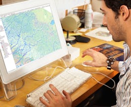
Skills you'll gain: ArcGIS, GIS Software, Data Sharing, Geographic Information Systems, Geospatial Mapping, Metadata Management, Data Quality, Data Mapping, File Management, Data Import/Export

Johns Hopkins University
Skills you'll gain: Transportation Operations, Land Management, Growth Strategies, Community Development, Civil Engineering, Geographic Information Systems, Environmental Issue, Policy Analysis, Feasibility Studies, Stakeholder Engagement

University of Michigan
Skills you'll gain: Geographic Information Systems, Geospatial Mapping, Spatial Data Analysis, Spatial Analysis, Interactive Data Visualization, Data Storytelling, Environmental Monitoring, Data Presentation, Forecasting, Trend Analysis

University at Buffalo
Skills you'll gain: Data Storytelling, Statistical Process Controls, Process Mapping, Data Ethics, Data-Driven Decision-Making, Data Collection, Process Improvement, Data Visualization Software, Business Process, Business Analytics, Tableau Software, Analytics, Data Analysis, Root Cause Analysis, Data Strategy, Minitab, Lean Methodologies, Six Sigma Methodology, Data Cleansing, Statistical Analysis
University of Toronto
Skills you'll gain: Geographic Information Systems, Geospatial Mapping, Data Mapping, Spatial Data Analysis, Data Visualization, Metadata Management, Quantitative Research, Typography, Data Cleansing, Data Validation, Design Elements And Principles, Data Integration

Johns Hopkins University
Skills you'll gain: Shiny (R Package), Data Visualization, Dashboard, Ggplot2, Interactive Data Visualization, Data Visualization Software, Data Presentation, Application Development, UI Components, User Interface (UI), Application Deployment

University of Colorado Boulder
Skills you'll gain: Linear Algebra, Integral Calculus, Algebra, Numerical Analysis, Calculus, Graphing, Applied Mathematics, Data Science, Data Analysis, Data Modeling, Probability & Statistics, Derivatives, Mathematical Theory & Analysis
In summary, here are 10 of our most popular geospatial mapping courses
- Aprende a programar con Python: Universidad Austral
- Desarrollo de aplicaciones móviles con Android: Universidad Nacional Autónoma de México
- Lean Software Development: University of Minnesota
- Building Data Visualization Tools: Johns Hopkins University
- Data Visualization in R with ggplot2: Johns Hopkins University
- Fundamentals of GIS: University of California, Davis
- Sustainable Regional Principles, Planning and Transportation: Johns Hopkins University
- GIS: Geographic Information Systems for Sustainability: University of Michigan
- Data-Driven Decision Making (DDDM): University at Buffalo
- GIS Data Acquisition and Map Design: University of Toronto


